Monday, May 29, 2017

Back to the Arctic: An anomalously radar-rough area

Hi, hi!

For this week's update, let's return up north to Axel Heiberg Island, NU.  Recently, I've been revisiting my radar and spectral images in preparation for our upcoming field season. In July, four of us will be visiting the island to ground-truth what we've been seeing in the satellite imagery, with a specific focus on the salt diapirs I've been studying. This will help us better understand the surface texture of the diapirs, how rough they are, and why they are producing the signatures we see in radar.

Part of the Canadian High Arctic, including Axel Heiberg Island, and most of Ellesmere Island. Boxed represents study area for Elise's research. Image credit at bottom right.

One area, not made of salt, is quite curious. There is nothing abnormal about it in the true-colour satellite imagery.

Overview of study area on Axel Heiberg Island. This "wall-and-basin structure" contains a high abundance of salt diapirs. Image credit same as above. Box outlines "weird" area.

But yet it appears very rough in C-Band radar.  More rough than the diapirs, even! Check it out:

RADARSAT-2 C-Band ciruclar polarization ratio (CPR) image over study area. The purple box surrounds anomalous radar rough area. The red circle outlines a large salt diapir for comparison.
That is super rough! How odd! But it definitely isn't salt, because the area doesn't show an anhydrite/gypsum signature in the spectral images:

Spectral (ASTER TIR) band composition of study site. Boxes are in same features as above image. Salt appears as dark maroon.  The mysterious radar-rough feature appears as dark blue.
Curiouser and curiouser! The rough area is appearing blue in the spectral image.  I'm not sure what that corresponds with in this band ratio - something to look up perhaps. However, we can definitely say it isn't salt.  Now, I know there are volcanic intrusions in the area, particularly in the Isachsen formation, so one of my ideas is that it could be made of lava. Lava is radar-rough.

I pulled up Harrison and Jackson's (2014) geological map of the site.  The area is mapped as Isachsen formation! At first I thought that confirmed my hypothesis that the area is lava, but then I looked at the detailed geological description of the units.  Whereas other Isachsen areas are mapped as basalt flows, or sedimentary units with localized volcanics, this area is just mapped as being limestone and siltstone.  No lava.  That is weird, because limestone shouldn't be producing a really rough signature. 

If we have time on one of our helicopter days in the field this July, I'd like to check it out!

RADARSAT-2 Data and Products (c) MacDonald, Dettwiler and Associates, Ltd. (2016) - All Rights Reserved. RADARSAT is an official trademark of the Canadian Space Agency.

Tuesday, May 16, 2017

Incised meanders - When uplift beats migration

Hello!

There has been a two-week hiatus in posts because I was at fieldschool! The Centre for Planetary Science and Exploration at Western hosts an annual/semi-annual planetary surface processes fieldschool in the southwest United States. As mentioned last post, we visited numerous sites in Arizona and Utah, where there are abundant geological and geomorphological features that shape the landscape. We tweeted extensively about the experience, and you can follow our updates and see many exciting pictures on the hashtag #PS9605.

One of my favourite sites that we visited might surprise you.  Even though we visited many famous sites like the Grand Canyon and Meteor Crater, I really appreciated Goosenecks State Park, Utah. I suppose my fluvial sedimentological side is showing!

To explain why I found this river channel so exciting, let's recall how meandering rivers form. There are four main types of river:
  1. Straight
  2. Anastamosing
  3. Braided
  4. Meandering
The shapes of these rivers are controlled by the slope gradient and types of materials being carried by the river. In general, the steeper the slope, the quicker the river moves and the larger sediments and grains it can carry. Meandering rivers are found in areas with the lowest slope gradient, and typically carry very fine grained sands and clays. 
Types of rivers (from University of Indiana course webpage)
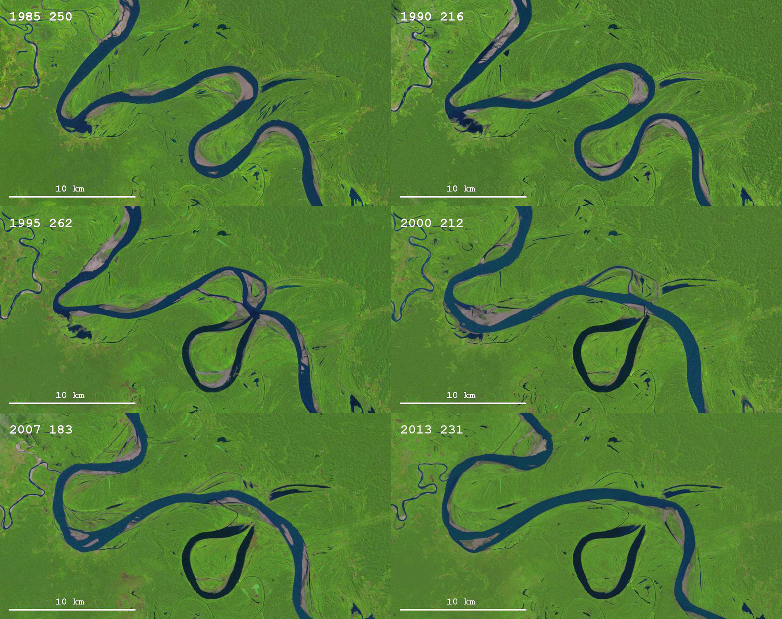
Water flows turbulently in river channels, and the water undergoes what we call "helical flow", that is the water is being driven in a corkscrew-like motion as it travels downsteam. Imagine the forces acting upon water in a river: water at the bottom and at the sides of the channel are slowed down by drag forces against the channel walls. Water in the middle and top of the stream is free to move more quickly. We also know that an object in motion likes to stay in motion. This means that the water at the top of the river channel has more momentum when it collides with a bend in the river.  The water gets forced down the wall, and any sediments it is carrying will erode into what we call the "cutbank" on the meander loop. That water is then forced across the bottom of the channel, losing momentum from the drag forces, and slows enough to begin depositing sediments on the other side (the "point bar"). This cycle repeats, and we get meandering rivers as the cutbank is cut away and the point bars build up.  Meandering rivers migrate - if they keep cutting away and building point bars eventually the channels will move back and forth across the landscape. Sometimes rivers will even cut themselves off, trapping ponded water called "oxbow lakes". 
Depiction of helical flow in a meandering river, note how water is
being driven down the cutback, across the bottom of the channel
and then up the point bar (via The British Geographer, source unknown)
It isn't easy to visualize that process in words, so here is an animated gif to illustrate the evolution of meandering rivers:
Source: The skeptical geologist at this blog

Let's bring this back to Goosenecks State Park, where the San Juan River has incised into 300 m of limestone, siltstone, sandstone and shale cliffs.

Just look at this landscape.


180° panorama of Goosenecks State Park (Elise Harrington 2017)

At first glance, you go, "Wow, yup, that is a meandering river!" because it shows very dramatic sinuousity.

But once you start remembering how the meander process works, a sneaking suspicion will creep up on you... It didn't migrate. There is no floodplain, here! Look at the above gif - we know that these types rivers move around through time and cut themselves off. Here, the river somehow stayed in one place for long enough to eroded and incise downwards rather than laterally.

The reason?  The same as why the Grand Canyon is so deep! Within the past 6 million years, the Colorado Plateau has undergone significant tectonic uplift.  Uplift dramatically exacerbates erosion. Imagine pushing down on an object. Now imagine that as you are pushing down, it is pushing back up at you! You intuitively know that the force you feel is stronger, and this helps rivers cut down into canyons like the Goosenecks and the Grand Canyon far more quickly than they otherwise would be able. Because the river is incising so deeply, so quickly (on a geological time scale, of course) it is not able to migrate and meander, and becomes "locked" and only able to cut down vertically.

Standing at the edge of the cliffs was spectacular.  My brain had a difficult time processing the scale of the river, and how deep the canyons were.  I highly recommend checking it out if you are in southern Utah!